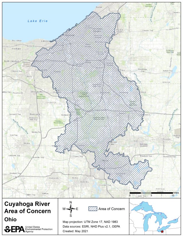
Cuyahoga River AOC Boundary Map
The Cuyahoga River AOC boundaries, established in 1988, originally included the lower 45 miles of the river from the Ohio Edison Gorge Dam at River Mile 45.1 in Cuyahoga Falls to the mouth of Lake Erie as well as approximately 10 miles of Lake Erie shoreline, from Edgewater Park on the west side of Cleveland to Wildwood Park on the east.
The Cuyahoga River AOC includes drainage from Big Creek, West Creek, Mill Creek, Tinkers Creek, Sagamore Creek, Chippewa Creek, Brandywine Creek, Furnace Run, Yellow Creek, Sand Run, Mud Brook, Euclid Creek, Doan Brook, and Dugway-Ninemile-Green Creeks. These watersheds are within Cuyahoga, Lake, Medina and Summit counties. The AOC includes the Cuyahoga Valley National Park, which preserves 22 miles of river between the primary urban/industrial centers of Akron and Cleveland. On July 21, 2010, the upper AOC boundary was extended to River Mile 46.5, which encompasses the Gorge Dam pool and its sediments.

The following files are available for download for the Cuyahoga River AOC:
