Rethinking Highways for Healthy Communities
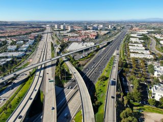
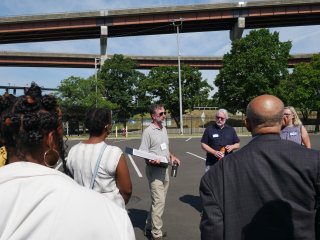
The Rethinking Highways for Healthy Communities pilot planning assistance program brings together communities historically divided by highway and transportation infrastructure. Through a collaborative planning assistance process, community leaders (such as local community developers, non-profit leaders and neighborhood leaders) work together to identify strategies that promote equitable land use redevelopment, restored access to nature and overall community wellness.
On this page:
Background
About the Program
The Rethinking Highways for Healthy Communities program supports communities taking proactive action to address land use and environmental planning within the context of broader transportation planning. New transportation investments, particularly highway redesign or removals, have major land use implications because the processes result in surplus land becoming available for redevelopment. For example:
- In Rochester, New York, the removal of Inner Loop East resulted in six acres of land for development.
- In Milwaukee, Wisconsin, 26 acres of land became available when the Park East Freeway was removed.
This program aims to:
- Strengthen coalitions seeking to develop a shared community vision for land use and redevelopment.
- Expand the capacity of community leaders to impactfully engage in the transportation planning and land use development process.
- Reconnect communities divided by transportation infrastructure to nature, including waterfronts, parks and other green amenities.

The Federal Aid Highway Act of 1956 authorized the creation of interstate highways to promote efficient cross-country travel. While our interstate highway system provides many societal and economic benefits, these highways have contributed to the construction of sprawling suburban development. Longer commutes in private vehicles became a greater contributor to greenhouse gas emissions and other air pollution. Some communities carried a higher burden as interstate highways displaced or bisected long-established communities.
Highway Impacts
In cities, highways fragmented communities and were often built directly through low-income neighborhoods. Research has found that redlined neighborhoods were three times more likely to have an interstate highway routed through them compared to other neighborhoods. In total, over the two decades that the interstate system was built, upwards of half a million homes were demolished and households displaced. Through the displacement of households and razing of small businesses, cultural institutions, and even medical facilities, the construction of highways altered the cultural, social and economic fabric of neighborhoods across the country. [1]
For the communities that remained, their proximity to highways led to disproportionately high exposure to automobile pollution and other environmental hazards. Researchers have found that the impact of living within 300 meters (1,000 feet) of highways is considerable. Heart disease, pre-term births, asthma, reduced lung function, and cardiopulmonary mortality risks as well as lung cancer risks have all been documented to be higher among residents living or attending school near major highways. Much of these health risks are driven by exposure to vehicular pollution and particulate matter. [2]
Highways through cities also destroyed neighborhood green spaces, such as acres of Liberty Park in Spokane, Washington, which was designed by American landscape architect Frederick Law Olmsted. In other cities, highways were developed along waterfronts like the Hudson River in Albany, New York, creating a monumental barrier between people and nature. And the destruction of green infrastructure in favor of pavement fostered the growth of urban heat islands. Over decades, highways have contributed to the degradation of natural habitats of urban areas, with contaminants and pollutants impacting urban watersheds, soil and vegetation over time.
Rethinking Highways Today
As midcentury highways are increasingly aging and in need of repair or replacement, communities divided by them are considering what to do next. New strategies propose re-designing highways to repair past harms and better serve and reconnect communities, particularly to waterfronts and new green infrastructure amenities. Broadly, some efforts have focused on turning aging highways into new assets including city streets (“boulevards”). This approach creates an opportunity for redevelopment of surplus land.
Additional strategies have included caps and stitches. Caps are deck plazas running on top of lowered freeways; they can support community amenities, like parks. These are also known as “land bridges” or “lids”. Stitches are wide bridges over highways; features could include bike lanes, seating and green space.
The U.S. Department of Transportation has begun to support such efforts through the Reconnecting Communities Pilot grant program. The purpose of the program is to advance community-centered transportation connection projects, with a priority for projects that benefit disadvantaged communities.
The Rethinking Highways for Healthy Communities planning assistance pilot complements U.S. DOT efforts by supporting neighborhood-level planning when a highway re-design process makes surplus land available for potential future development.
Partner Communities

EPA, in collaboration with the Community Connectors program, identified potential communities to participate in the 2024 pilot program. The Community Connectors grant program was created with support from the Robert Wood Johnson Foundation, Smart Growth America in collaboration with Equitable Cities, the New Urban Mobility Alliance and America Walks to advance projects to reconnect communities separated or harmed by transportation infrastructure. The Rethinking Highways for Healthy Communities program will build upon this support with a focus on land use and environmental planning concerns.
EPA’s Rethinking Highways for Healthy Communities program is engaging with two communities in 2024. These communities were recommended by the Community Connectors team. In both communities, coalitions are working to address past harms and identify forward-thinking land use solutions.
- Albany, New York: The Albany Riverfront Collaborative will engage communities and expand civic partnerships through a convening to explore equitable development strategies to reconnect neighborhoods to the Hudson Riverfront along the I-787 corridor in Albany. This project will also explore models for community benefit agreements that could be integrated into a future redevelopment process.
- Spokane, Washington: The City of Spokane will engage community stakeholders in the East Central neighborhood, historically bifurcated by I-90, in an early-stage visioning and planning process focused on the neighborhood and land use implications of the future North Spokane Corridor. This project looks at an opportunity made possible through landmark state legislation (Senate Bill 5853) to transfer surplus land owned by state government to community groups for redevelopment.
[1] Megan Kimble. City Limits: Infrastructure, Inequality, and the Future of America's Highways. 2024.
[2] Urban Institute. The Polluted Life Near the Highway. 2022.
