StreamCat Dataset - ReadMe
Be sure to check here for recent updates and corrections to the StreamCat Dataset
On this page:
- A detailed description of the StreamCat Dataset and its development is now available in the Journal of the American Water Resources Association.
-
Please include the following citation in any publication or presentation including StreamCat data: Hill, Ryan A., Marc H. Weber, Scott G. Leibowitz, Anthony R. Olsen, and Darren J. Thornbrugh, 2016. The Stream-Catchment (StreamCat) Dataset: A Database of Watershed Metrics for the Conterminous United States. Journal of the American Water Resources Association (JAWRA) 52:120-128. DOI: 10.1111/1752-1688.12372.
Geospatial Framework and Terms
The StreamCat Dataset was built using the NHDPlusV2 geospatial framework.
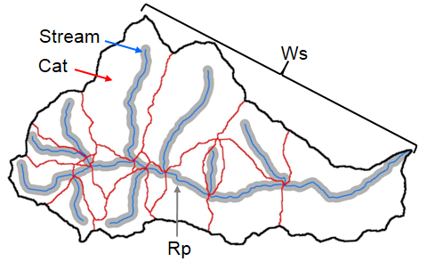
- Stream segments - Contiguous section of stream or river (Fig. 1) between upstream and downstream tributaries (except where segment is a headwater or outlet stream). Stream segments are based on digitized line files of USGS topographic maps (National Hydrography Dataset).
- COMID - Stream segment unique identifier. (Note that in some NHDPlusV2 files, such as catchments shapefiles, COMID is labeled as ‘FEATUREID’ in attribute tables)
- Catchment (Cat) - Portion of landscape that drains directly to an NHD stream segment, excluding any upstream contributions (Fig. 1).
- Watershed (Ws) - Set of hydrologically-connected catchments, including all upstream catchments that flow to any focal catchment (Fig. 1).
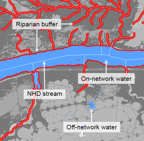
- Riparian Buffer (Rp) - Spatial buffers of 100-m that were added to the NHDPlusV2 stream network (Figs. 1 & 2) and to NLCD water pixels in contact with NHDPlusV2 stream lines (Fig. 2). The buffers were used to spatially constrain calculations of some landscape metrics to within 100 meters of the NHDPlusPlusV2 stream lines and on-network NLCD water pixels.
Data Structure & Distribution
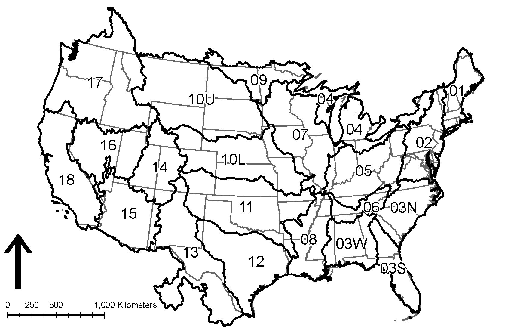
Data are distributed via API (Swagger documentation found here) and can be easily accessed using our Map or Table tools. Within States or HydroRegions, data are distributed by major data source (e.g., STATSGO Soils, National Land Cover Database).
Each table contains ancillary information about data completeness followed by catchment and watershed metrics:
- COMID - Stream segment unique identifier that can be linked to NHDPlusV2 stream or catchment shapefiles.
- CatAreaSqkm - Area of catchment (km2).
- CatPctFull - % of catchment that overlaps with landscape layer. Accounts for areas of NoData pixels and international borders.
- WsAreaSqkm - Area of watershed (km2).
- WsPctFull - % of watershed that overlaps with landscape layer. Accounts for areas of NoData pixels and international borders.
- Cat Metrics - Suite of catchment-level metrics.
- Ws Metrics - Suite of full watershed-level metrics.
- The StreamCat Dataset was built within the NHDPlusV2 framework and shares a common identifier with the NHDPlusV2.
- This unique identifier is ‘COMID’ in both NHDPlusV2 line shapefiles (NHDFlowline.shp) and StreamCat Dataset.
- In the NHDPlusV2 catchment shapefiles (Catchments.shp) this identifier is called ‘FEATUREID’ rather than ‘COMID’
- Users can join the StreamCat Dataset to stream or catchment shapefiles that are available for download (also by HydroRegion) from the NHDPlusV2 website.
- It is strongly recommended that potential users of the StreamCat Dataset first familiarize themselves with the NHDPlusV2 (see NHDPlusV2 User Guide).
Additional Notes
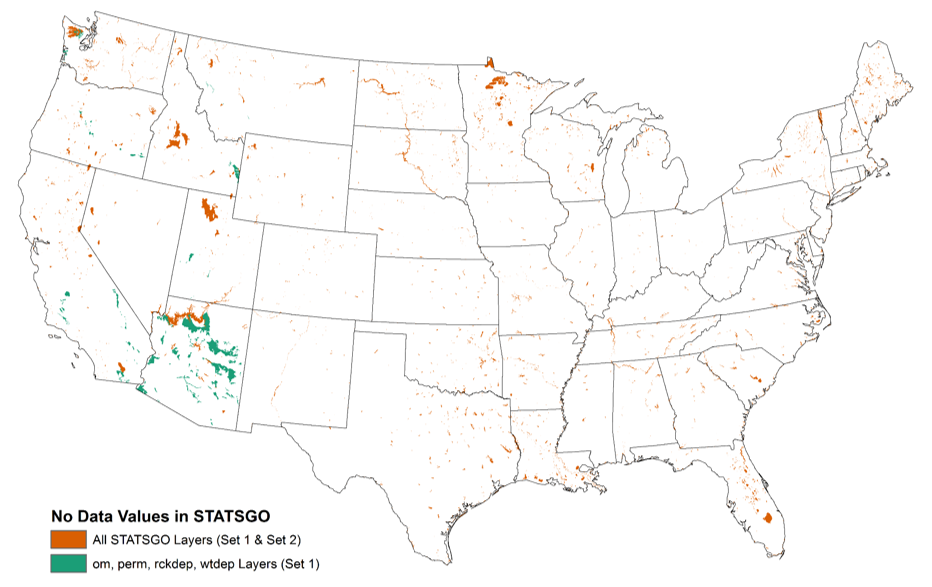
- STATSGO Set1 vs. Set2 - Some STATSGO soil rasters differed in terms of the locations of NoData pixels (Fig. 4). Some NoData values were common across all layers (orange in map). However, Om (organic matter), Perm (permeability), RckDep (rock depth), and WtDep (depth to water table) contained more NoData pixels (green in map) than Clay and Sand. Clay and Sand are distributed in STATSGO Set1 and the remaining STATSGO metrics are distributed in STATSGO Set2. Doing so allowed us to report the % of each catchment and watershed that contained pixels with data (CatPctFull and WsPctFull in data tables) for each set of common soils rasters.
-
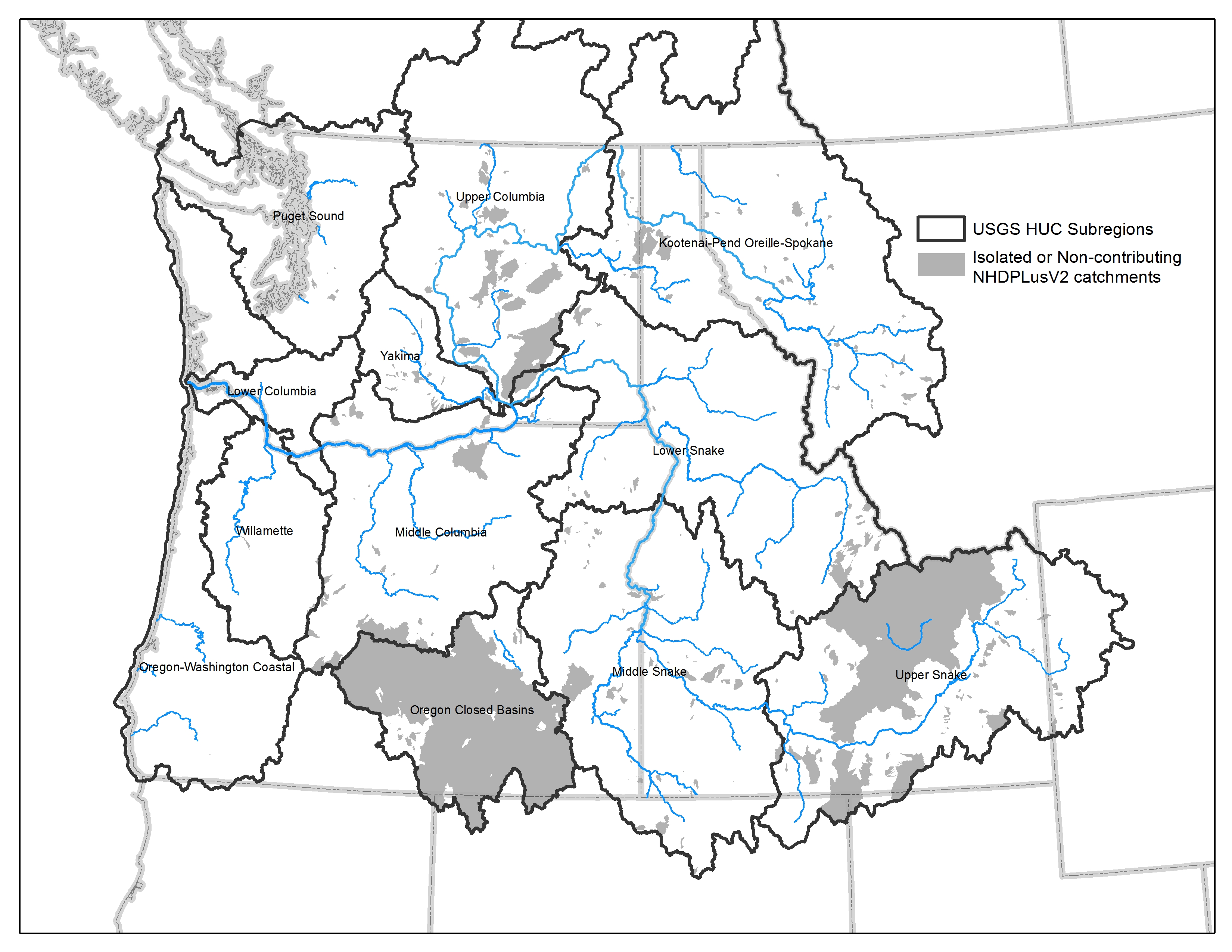
Internally draining basins - Within the NHDPlusV2, some basins are internally draining or otherwise not topologically connected to the greater river network (Fig. 5).
For example, portions of the Upper Snake River watershed (grey in figure below) have internal hydrologic connections but are not connected topologically to the Snake River. Where these connections occur, the StreamCat Dataset contains watershed-level summaries of landscape information.
In a second example, a portion of southeastern Oregon contains watersheds that are internally flowing, that is, they belong to a closed basin that does not contribute to a larger river network. However, the NHDPlusV2 contains the individual connections within this region and the StreamCat Dataset contains watershed metric summaries where these connections exist.
Although these data have been processed successfully on a computer system at the United States Environmental Protection Agency (EPA), no warranty expressed or implied is made regarding the accuracy or utility of the data on any other system or for general or scientific purposes, nor shall the act of distribution constitute any such warranty. It is also strongly recommended that careful attention be paid to the contents of the metadata file associated with these data to evaluate data set limitations, restrictions, or intended use. The EPA shall not be held liable for improper or incorrect use of the data described and/or contained herein.

