ICLUS Data for the Southeast Region
ICLUS data (version 2) outputs made available to the regional groups of the National Climate Assessment consist of populations. The projections are based on the 2010 U.S. Census and use fertility, mortality and immigration rates from the Wittgenstein Centre to project decadal population to 2100. These projections are therefore consistent with the demographic assumptions of the SSP2 and SSP5 socioeconomic scenarios. ICLUS population projections are used as inputs to a land use model, which spatially allocates five residential land uses (exurban-low, exurban-high, suburban, urban-low, urban-high) as well as commercial and industrial.
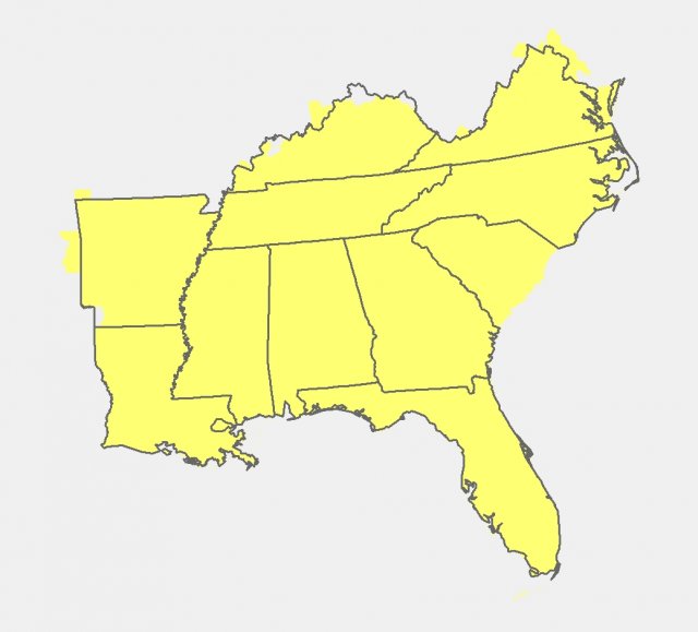
Datasets available below cover the Southeast region. All datasets are compatible with standard geographic information systems.
| Dataset to download | Description | Metadata |
|---|---|---|
| Population Data (SSP2 & SSP5) | 3.8Mb, Shapefile format | Population Projections |
| Land Use Data (SSP2) | 501 MB, GeoTIFF format | ICLUS v2.1 Land Use Projections (SSP2) |
| Land Use Data (SSP5) | 508 MB, GeoTIFF format | ICLUS v2.1 Land Use Projections (SSP5) |
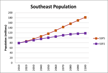
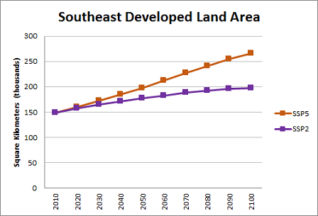
The graphs below provide an overview of population and developed land area trends across the two scenarios, SSP2 and SSP5, over time for the Southeast region.
Related Link
Additional Information about ICLUS


