Development of the Regional SDAMs
On this page:
- Why Develop Regional SDAMs?
- Map of Regional SDAMs
- Regional SDAM Coverage
- Steps taken to develop the Regional SDAMs
Long-term hydrologic data to assess streamflow duration are often limited, especially for streams that do not flow year-round and collecting enough hydrological data to classify stream flow duration can take years. Streamflow duration is one of the most ecologically important aspects of a stream’s hydrology. Streamflow Duration Assessment Methods (SDAMs) provide a scientifically supported, rapid assessment framework to support best professional judgment in a consistent, robust, repeatable, and defensible way.
Regionally specific SDAMs account for important differences and geographical variation in climate, geology, biogeography, and topography that can influence the relationships between field indicators and streamflow duration (Fritz et al., 2020). Tailoring the methods to regional conditions helps assure accuracy.
Map of Regional SDAMs
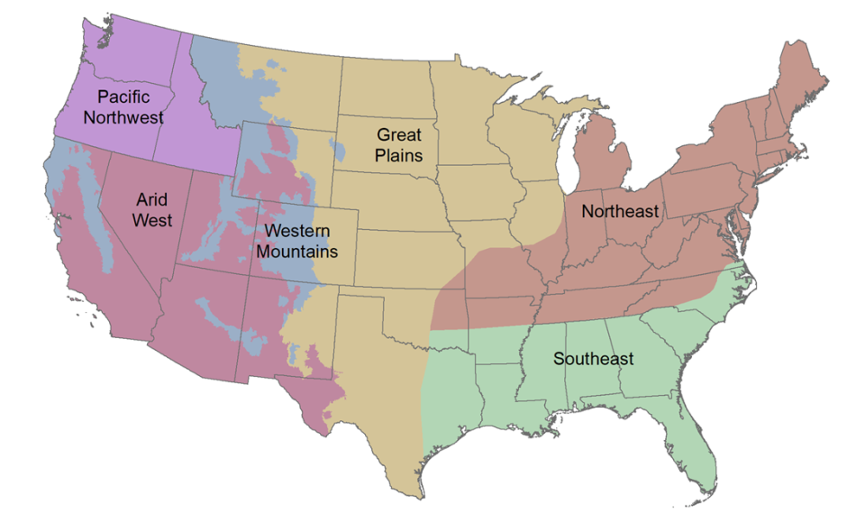
Regional SDAM coverage
Regional SDAMs are available for the coterminous United States. The SDAM for the Pacific
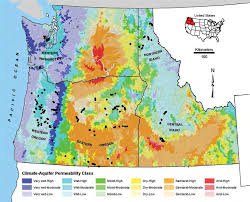
Northwest (PNW), covering the states of Idaho, Oregon, and Washington, has been in use since 2015. Data collection efforts to develop the Arid West (AW) method began in 2018, followed by Western Mountains (WM) in 2019.
Data collection for the Northern Plains and Southern Plains (collectively referred to as the Great Plains, GP) as well as the Northeast (NE) and Southeast (SE) regions began in 2019 and 2020, respectively. The AW, WM and western boundary of the GP is defined by the Arid West (U.S. Army Corps of Engineers 2008) and Western Mountains, Valleys and Coast (U.S. Army Corps of Engineers 2010) regional supplements to the U.S. Army Corps of Engineers wetland delineation manual. The eastern boundary of the GP and the NE and SE boundaries are based on gradients in climate, dominant native vegetation type, hydrology, geology and topography as outlined in the Corps Ordinary High Water Mark Scientific Support Document. View the 2016 Technical Report, Synthesizing the Scientific Foundation for Ordinary High Water Mark Delineation in Fluvial Systems (PDF). The final NE and SE SDAMs are anticipated in early 2025 and will replace the beta versions.
Literature Reviews to support development of the AW, WM, GP, NE and SE SDAMs are available with each of the beta SDAMs. Literature Reviews to support SDAMs for Alaska and Hawaii have been completed. A literature review is underway for the U.S. Caribbean.
Steps taken to develop the Regional SDAMs
The EPA and partners conducted multi-year studies to develop regionally-specific SDAMs for use across the coterminous U.S. generally following the steps outlined below. Read more about the scientific basis and operational framework for developing Regional SDAMs.
-
Preparation: At the outset of the project, a regional steering committee was established for each region, consisting of geographically relevant technical staff at Corps Districts and EPA Regional Offices that manage programs where streamflow duration information is often needed (e.g., Clean Water Act programs, including permits and enforcement). Committee members were selected based on their expertise in both scientific and programmatic elements relevant to streamflow duration classification needs. The regional steering committees served several functions in the development process, including reviewing technical products, facilitating connections with local experts, identifying resources such as sources of hydrologic data, providing input on the model selection and refinement, and conducting outreach training on the methods.

Oak leaf with sediment deposition from a stream. Candidate indicators expected to control or respond to streamflow duration were identified that are supported by the scientific literature or used in existing SDAMs and included some or all of the following categories: geomorphological, hydrological, biological, and geospatial. Because the goal of an SDAM is to classify reaches by flow duration, which represents the typical regime over many years, indicators reflecting flow duration over longer periods of time were favored over those that reflect more immediate flow conditions. Following input from the regional steering committees, these candidate indicators were then screened using the criteria described by Fritz and co-authors (2020), including:
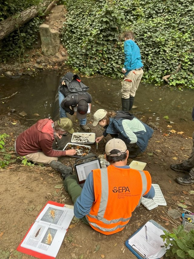
Collecting SDAM field indicators.
Consistency: Does the indicator consistently discriminate among flow duration classes (e.g. demonstrated in multiple studies)?
Repeatability: Can different practitioners take similar measurements, given sufficient training and standardization?
Defensibility: Does the indicator have a rational mechanistic relationship with flow duration, as either a response or a driver?
Rapidness: Can the indicator be measured at the reach during a one-day visit (even if subsequent lab analyses are required)?
Objectivity: Does the indicator rely on objective (often quantitative) measures, as opposed to subjective judgments of practitioners?
Robustness: Does human activity complicate indicator measurement or interpretation (e.g., poor water quality may affect the expression of some biological indicators)?
Practicality: Can practitioners realistically sample the indicator with typical capacity, skills, and resources?
Candidate indicators were also included in the study if they were used in an existing SDAM in or near the region. The list of potential indicators of flow duration supporting the development of a regional SDAM are provided in the data analysis report for development of the beta methods and were subsequently narrowed during model development.
-
Data collection: For each region, a set of stream reaches were chosen as the indicator sampling sites for SDAM model development. Sites were identified to include clusters of perennial, intermittent, and ephemeral reaches based on existing hydrological data. The clusters of sites were spread throughout different parts of each region to encompass a wide range of hydrological, ecological, and climatic characteristics. Reaches were prioritized for study inclusion based on being accessible (e.g., on public property or with landowner permission), being wadable, and the number and type of data sources available to determine actual streamflow duration classification.
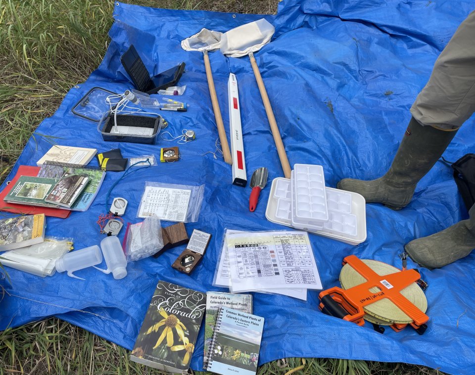
Equipment needed to measure field indicators for use in Regional SDAMs. Many sites having few or no existing data sources indicating actual streamflow duration class were instrumented with one or more Stream Temperature, Intermittence, and Conductance (STIC; Chapin et al. 2014) loggers for one to two years, which were calibrated to detect the presence of water. During each visit to an instrumented site, the recorded logger data (direct measure of flow duration) were downloaded and all indicator data were collected. These instrumented sites were visited multiple times during the study. The Hydrologic Data Dashboard was used to manage the extensive, nation-wide network of STIC loggers to characterize flow duration, frequency, and timing in perennial, intermittent, and ephemeral streams. The tool merges, summarizes, and allows users to efficiently evaluate high frequency hydrologic data. Post-sampling reach classifications were reviewed in light of the logger data and hydrology indicator data that were direct measures of water presence collected during each visit.
Sites with multiple sources of data about actual streamflow duration classification or existing hydrologic data records (e.g. a USGS stream gage) were more likely to have an independently-assigned flow duration classification (perennial, intermittent, or ephemeral) and a single collection date for streamflow indicator data.
- Method development: Data-driven regionally specific beta methods were developed using the first year of field sampling data from each region. SDAM accuracy was assessed using a suite of evaluative performance measures, which emphasized differentiating between ephemeral and non-ephemeral streams, and wet versus non-flowing streams. This step also included internal peer-review and interagency comment prior to release of the beta SDAMs. Each method’s development and evaluation were documented in a data analysis supplement. Watch this webinar presentation from April 13, 2023 to learn more about the five regional beta methods.
-
Continued sampling: STIC loggers were maintained at all instrumented sites in the GP and NE and SE, and data collection continued for up to another year to ensure that method development was not biased by interannual climatic and streamflow variation. In the AW and WM, additional single visit and instrumented sites were added throughout the regions and instrumented sites were visited three times over the course of a year.
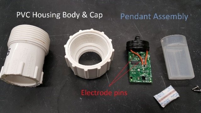
Disassembled Stream Temperature, Intermittence, and Conductance (STIC) logger used to directly measure flow duration at instrumented study reaches. (photos: Cody Schumacher) 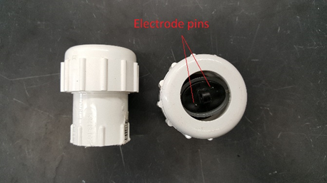
Assembled Stream Temperature, Intermittence, and Conductance (STIC) logger used to directly measure flow duration at instrumented study reaches. (photos: Cody Schumacher)
- Production of final Regional SDAMs The Regional SDAMs were developed to improve upon the beta methods in terms of accuracy and ease of use in the field. This effort included reevaluating regional boundaries (a better approach to regional boundaries was not identified), incorporating additional data collected from across the country, and reviewing and addressing feedback from use and implementation of beta SDAMs. The same model development process described in this section for production of the beta SDAMs was followed to produce the final Regional SDAMs from all the data collected within the region. For each method, model refinements led to different indicators than used in the beta SDAMs.
The SDAMs used random forest machine learning models to develop the beta and final Regional SDAMs, and for most of the SDAMs the resulting random forest model must be used to classify flow duration. Random forest is a machine learning model that uses many decision trees, e.g., a “forest,” to predict the streamflow classification. Each decision tree in the forest uses a subset of the geomorphological, hydrological, biological and geospatial indicators identified as most important for making consistent and accurate classifications of streamflow duration for a random subset of the training data. For more information on how random forest models were used to develop the beta SDAMs, see Gross et al. 2023. Learn more about using random forest modeling.
- Rollout of Regional SDAMs: To announce the availability of the Regional SDAMs, a Joint Public Notice was issued by the Environmental Protection Agency and the Army Corps of Engineers. The rollout for both beta and final Regional SDAMs included engagement with stakeholders, as well as technical support and training for staff. A public comment period on the beta methods, external peer-review, and any final revisions are also included in this step. Read more about the development and evaluation of each of the beta SDAMs.
For ease of implementation, a user-friendly open-access Web Application for Regional SDAMs has been developed for entering SDAM indicator data and running the developed random forest model to obtain the classification for individual assessment reaches. The SDAM for the PNW does not require use of the web application to obtain a classification, but the web tool is necessary for obtaining a classification in the other regions.
